


 Laser scanning enables remote measurements of hundreds of thousands of points per second with their millimetre precision. Every point has got not only its coordinates: X, Y, Z, but also the intensity of reflected signal or colour. The operation in the "cloud of points" stands for both realistic visualisations, precise measurements in space moved into virtual reality and grounds for advanced spatial modelling and reverse engineering.
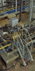
Our scanner is a medium-range instrument with its scanning speed of 976 000 points per second. The range of 120 metres is a good compromise between the maximum distance which can be scanned and the millimetre precision of point location. At the same time by means of the scanner the following tasks can be successfully performed: architectural and building inventories, inventories of archaeological sites, conservation works, inventories of complex industrial and engineering premises, volumetric measurements of landfills made of bulk materials, monitoring of shifts and deformations as well as inventories of operational progress at opencast mining plants and facilities, in particular quarries.