We prepare and develop studies and documentation for the restoration of monuments; we render geodetic services within these works and archaeological works. We use various measurement technologies (traditional measurements, photogrammetry, laser scanning) and we use a variety of software which allows to prepare and develop final studies and documentation in their digital form in the most popular data formats. We specialise in short-range digital photogrammetry and aerial photography.
We offer the following services to specialists in the field of restoration of monuments and archaeology:
ARCHITECTURAL - CONSTRUCTIONAL INVENTORIES
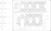
We perform architectural - constructional inventories of interiors and façades of buildings (also historic sites) for the purposes of reconstruction, repairs and arrangements etc. We make inventories of both structural elements, such as historic roof truss systems as well as interior details or architectural components. We prepare and develop drawings of façades, roofs, cross-sections, plans etc. We provide our clients with the documentation both in the traditional form as well as the digital format. We specialise in making the inventories by photogrammetric methods as well as with the aid of 3D laser scanning. >>>
INVENTORIES OF ARCHAEOLOGICAL WORKS
We conduct inventory works at archaeological positions. We apply various measuring techniques depending on the type of position, its availability, dimensions and expected documentation. We specialise in inventories by means of photogrammetric methods by which we make inventories of both these archaeological positions as well as all the excavated exhibits. We provide our clients with the documentation, including models of excavated exhibits, both in the traditional format as well as digitally in the form of CAD-typed files and pdf files. We provide the accomplished photograms digitally in the form of bitmap files.
 PHOTOGRAMMETRIC PROJECTS
We specialise in short-range, both ground as well as aerial, photogrammetry. The short-range photogrammetry primarily stands for the accuracy of setting the ordinates at the level of individual decimetres, centimetres or even millimetres. Thanks to that, by means of photogrammetric methods, we perform projects in the scope of both land survey and height measurements and mining surveying, but also in the range of architecture, archaeology, conservation of monuments and even engineering measurements, such as inventories of objects at confined places, monitoring of deformations, determination of volumes etc. >>>

3D LASER SCANNING
We make inventories using 3D laser scanning. We scan historic and industrial buildings, interiors, façades, natural monuments, steel constructions, operational walls of quarries, requiring detailed and prompt inventories of objects to be covered up etc. The range of applications is virtually unlimited. The technology is irreplaceable at all the places where time, precision, objectivity, completeness count. A colourful "cloud of points" being the base for implementation of derivative projects ranging from cross-sections, projections, views up to realistic 3D models comes out as the primary product. >>>
 DIGITAL PROJECTS
To our clients we offer implementation of digitally-formatted projects both in vector-based graphics as well as bitmaps. We have got a variety of software which ensures saving end-effects in most available formats. These range from CAD-based files, typical bitmap files as well as formats related to publication (including electronic publication) and printing. We scan, calibrate, vectorise archival cartographic and project documentation. We make print-outs and plotted drawings at the highest quality equipment of both minor and major format.
AERIAL PHOTOGRAPHY
As the company specialising in photogrammetry services we have got the experience and equipment, so that to our clients we offer imaging "from bird's eye view". For this purpose we most often use our photogrammetric balloon constructed on the basis of our design, which lifts a high-class reflex camera up to the level of 200 metres. Whatever is photographed at the moment is available at the screen at the ground. Remote control of camera rotation is also done from the ground. We use a leased plane to take imaging from higher levels. As far as possible - we invite you to joint the flight!


